
'Emong' intensifies into Tropical storm; heads North
2013-Jun-18 12:05
2025-Jan-08 07:34
http://www.pagasa.dost.gov.ph/
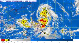
Tropical Storm "Emong" was estimated based on all available data at 460 km East of Isabela, Cagayan (17.3°N, 126.5°E), as of 10 A.M..
Maximum sustained winds of 65 kph near the center and gustiness of up to 80 kph. Forecast to move North at 19 kph.
Tropical Storm "Emong" is expected to be at 470 km East of Basco, Batanes by tomorrow morning. By
Thursday morning, it will be at 830 km Northeast of Basco, Batanes out of Philippine area of responsibility (PAR).
Thursday morning, it will be at 830 km Northeast of Basco, Batanes out of Philippine area of responsibility (PAR).
Estimated rainfall within the 400 km diameter of the Tropical Storm is from 5-15 mm per hour (moderate-heavy).
Tropical Storm "Emong" is still far to directly affect any part of the country. However, it will enhance the Southwest Monsoon which will bring moderate to occasionally heavy rains and thunderstorms over Southern Luzon, Visayas and Northern Mindanao.
Fishermen specially using small seacrafts are advised not to venture out into the northern and eastern seaboards of Luzon and western seaboards of Southern Luzon due to big waves generated by Tropical Storm "Emong." (PNA)