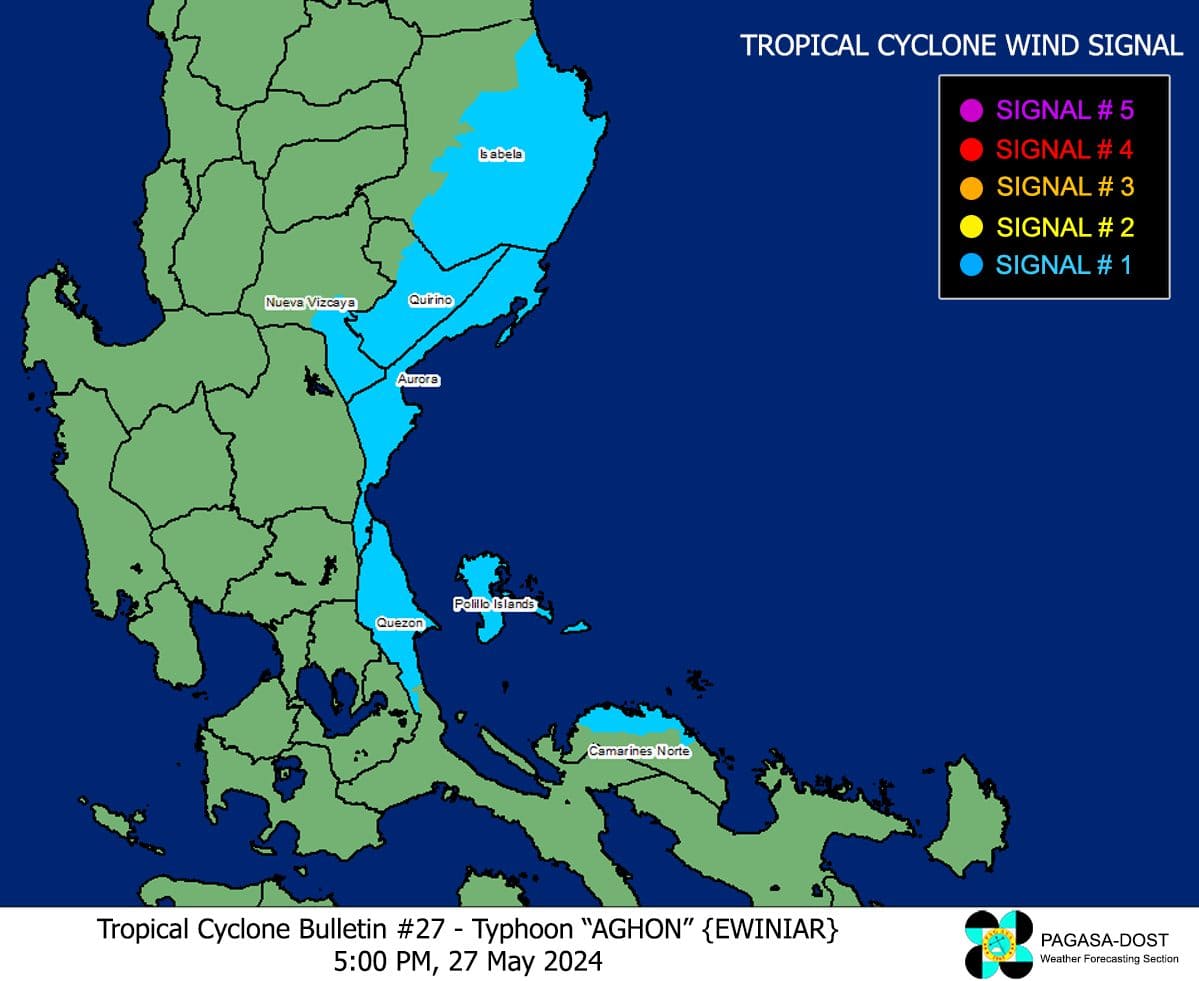
Parts of Luzon under Signal No. 1 as Aghon moves away from PH landmass
2024-May-27 18:20
2024-Dec-01 05:25

Photo from: PAGASA
MANILA – Some areas in Luzon remained under Tropical Cyclone Wind Signal (TCWS) No. 1 as Typhoon Aghon moved away from the Philippine landmass, the weather bureau said Monday afternoon.
In its 5 p.m. bulletin, the Philippine Atmospheric, Geophysical and Astronomical Services Administration (PAGASA) said Aghon was last tracked 155 km east of Casiguran, Aurora, moving east northeastward at 10 kph.
Aghon packed maximum sustained winds of 140 kph near the center and gustiness of up to 170 kph.
TCWS No. 1 is still up over Quirino (Maddela, Nagtipunan, Aglipay), Nueva Vizcaya (Alfonso Castaneda, Dupax del Sur, Dupax del Norte), Isabela (Divilacan, San Mariano, San Guillermo, Jones, Echague, San Agustin, Ilagan City, Benito Soliven, City of Cauayan, Maconacon, Angadanan, Naguilian, Palanan, Dinapigue), Aurora, Quezon (General Nakar, Infanta, Real) including Polillo Islands, and Camarines Norte (Vinzons, Paracale, Jose Panganiban, Capalonga).
These areas may experience minimal to minor impacts from strong winds.
The typhoon is forecast to exit the Philippine Area of Responsibility on Wednesday.
PAGASA said Aghon is less likely to directly bring a significant amount of rainfall in the next three days. However, it could enhance the southwesterly windflow which could cause moderate to heavy rains over Western Visayas and portions of Mimaropa in the next two days.
Meanwhile, a gale warning was hoisted over the coastal waters of Cagayan (southern portion), Isabela, Aurora, and the northern coastal waters of Quezon including Polillo Islands.
Sea travel was deemed risky for small seacraft, including all motor bancas of any type of tonnage, according to PAGASA.
Aghon continued to cause moderate to rough seas over the eastern coastal waters of Cagayan and the northern coastal waters of Bicol Region.
PAGASA advised mariners of motor bancas and similarly-sized vessels to take precautionary measures. (PNA)
