PBBM to LGUs: Brace for Leon's impact
2024-Oct-30 14:24

(PAGASA)
MANILA – President Ferdinand R. Marcos Jr. directed Wednesday the affected local government units (LGUs) to be prepared for the possible impact of Super Typhoon Leon (international name Kong-rey).
Marcos gave the order during the opening of the Maersk Optimus distribution center in Calamba City, Laguna.
"Unfortunately, mukhang may padating na naman. Kaya't paghandaan natin nang mabuti (it looks like there's another one coming. So let's prepare well)," Marcos said.
During the event, Marcos also lauded Laguna Gov. Ramil Hernandez for "working very hard" to help his constituents who were affected by Severe Tropical Storm Kristine (international name Trami) that battered most parts of Luzon and other parts of the Visayas last week.
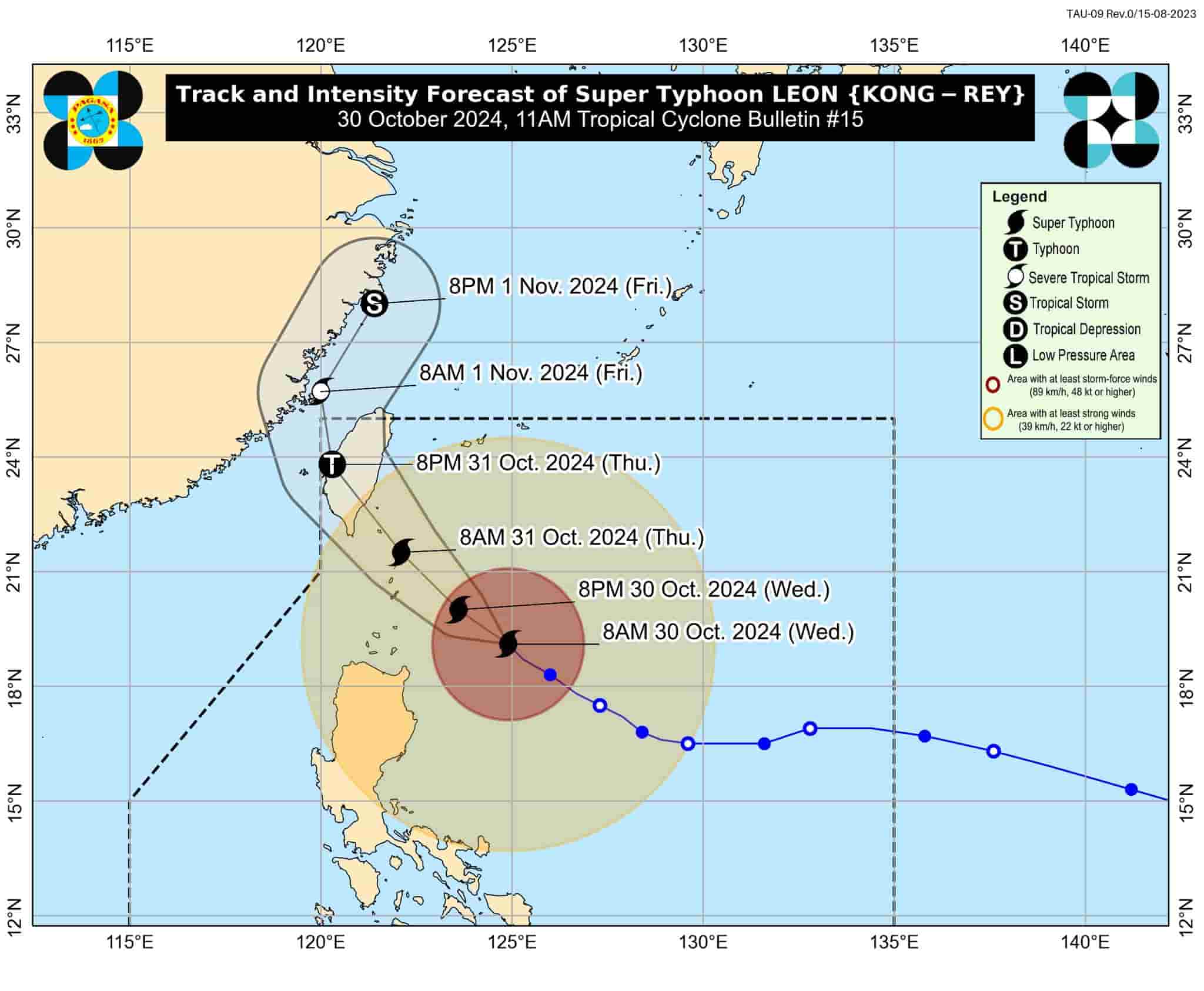
Leon continued to threaten extreme northern Luzon as it intensifies further, according to an 11 a.m. weather bulletin released by the Philippine Atmospheric, Geophysical and Astronomical Services Administration (PAGASA).
Moving west-northwest at a speed of 10 km. per hour, Leon packed maximum sustained winds of 185 kph near the center and gustiness of up to 230 kph.
PAGASA raised Tropical Cyclone Wind Signal (TCWS) No. 3 in Batanes, the eastern portion of Babuyan Islands, and the northeastern portion of mainland Cagayan (Santa Ana).
TCWS No. 2 was hoisted over the rest of Babuyan Islands, the rest of mainland Cagayan, the northern and eastern portions of Isabela, Apayao, Kalinga, the northern and eastern portions of Abra, the eastern portion of Mountain Province (Paracelis), and Ilocos Norte.
The rest of Isabela, Quirino, Nueva Vizcaya, the rest of Mountain Province, Ifugao, Benguet, the rest of Abra, Ilocos Sur, La Union, Pangasinan, Nueva Ecija, Aurora, the northeastern portion of Tarlac, the northern portion of Bulacan, the northern portion of Quezon, including Polillo Islands, Camarines Norte, the northern portion of Camarines Sur and the northern and eastern portions of Catanduanes were placed under TCWS No. 1.
PAGASA said Leon will be closest to Batanes from late Wednesday evening to Thursday morning.
"A landfall in Batanes is also not ruled out. This super typhoon will be near or at peak intensity during its closest point of approach to Batanes," it said. (PNA)
